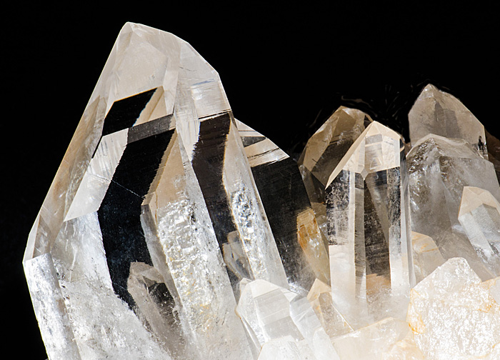
Geology Stock Pictures
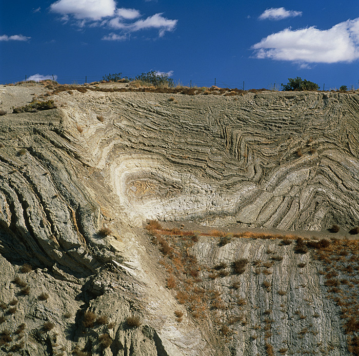
SJ3885 - San Andreas fault. Folded rock strata exposed in a roadside cliff cutting through the San Andreas fault. The twisting and folding is caused by tectonic forces. The San Andreas fault is one of the world's great seismic faults, forming the boundary between the Pacific and North American tectonic plates. The San Andreas fault extends almost the full length of California. Photographed on Highway 14 near Palmdale, California, USA.
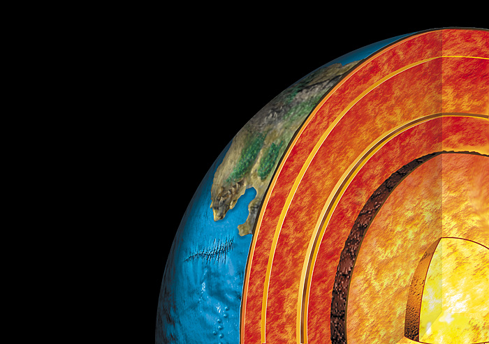
SA7238 - Earth's structure. Cutaway computer illustration of the internal structure of the Earth. The inner Earth is divided into several distinct layers. The top layer, the crust that forms the land and underlies the seas. Below around 4 kilometers down (at 110 degrees Celsius), no more life is found. The next layer is the upper mantle, on which the crust floats. Two more mantle layers are found below this, consisting of molten rock between 1500 and 3000 degrees Celsius. Around half way to the center of the Earth is the outer core (inside brown shell) of liquid iron and nickel, overlying the solid inner core of mainly iron.
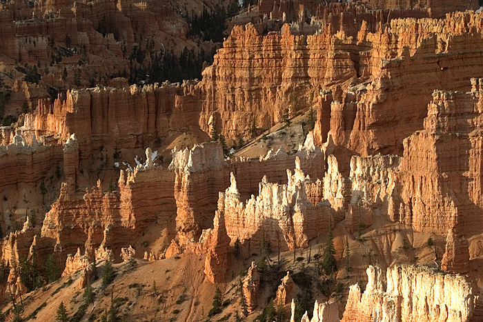
BC7988 - Hoodoos, limestone, sandstone, and mudstone spires, fins, pinnacles, and mazes formed by erosion, in Bryce National Park in Utah.
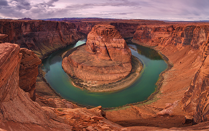
BZ8615 - Horseshoe Bend is the name for a horseshoe-shaped meander of the Colorado River located near the town of Page, Arizona, in the United States. January
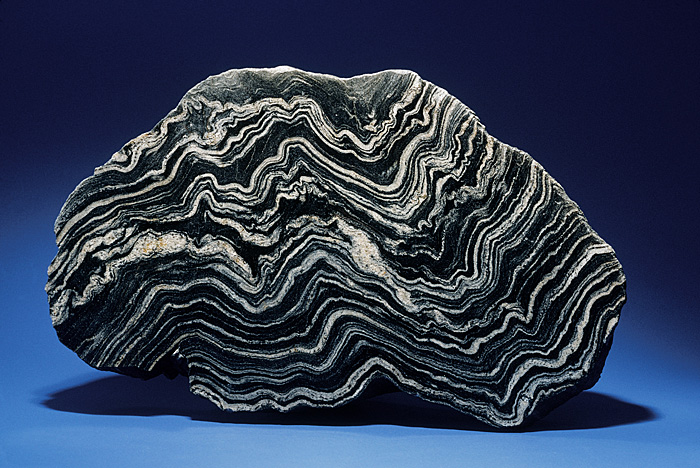
BK1827 - Schist is a metamorphic rock that displays a foliated (folded) texture as a result of intense pressure that causes alignment of platy minerals. Metamorphism, intense heat and pressure, causes the rearranging or recrystallization of components in a rock, to create a new rock with new minerals. These forces also bend and crumple rocks in a characteristic way, well illustrated by the metamorphic rock known as schist.
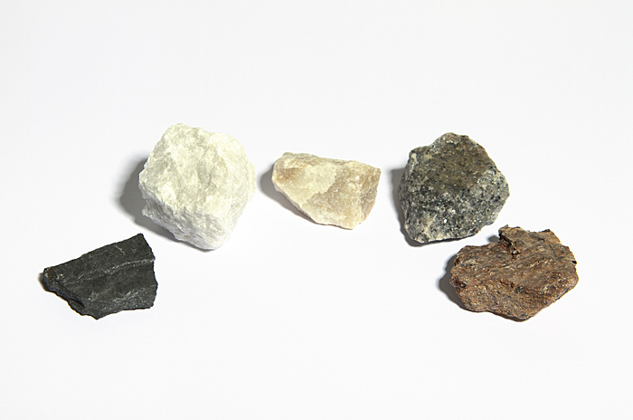
BY2392 - Metamorphic rocks, left to right: slate, marble, quartzite, gneiss, schist.
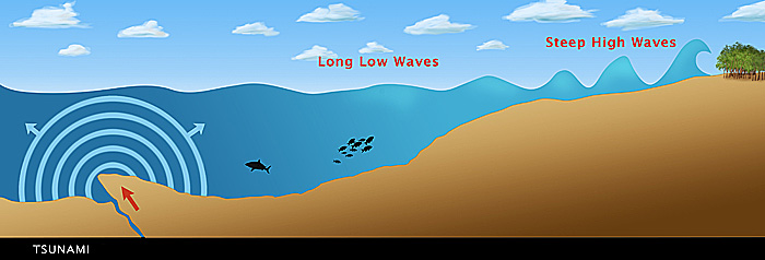
BY4136 - Illustration of a tsunami formed from an earthquake (crack in the ocean floor), showing the variation in wavelength and height as the tsunami reaches shallow water. In the open ocean, tsunamis are very shallow with a very long wavelength, and can travel extremely fast, up to 1000 kilometers per hour. However, when the wave reaches shallower water, the waves are slowed and pile up, reducing the wavelength and increasing their height. Unlike normal waves, tsunamis do not break and then recede, the initial wave is followed by an enormous mass of water, which causes the majority of the damage. Tsunamis are caused by a displacement of the seabed, for instance by earthquakes, landslides or volcanic eruptions.
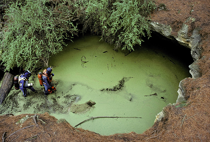
FB0567 - Cave divers entering The Pines, a sinkhole in South Australia surrounded by pine needles from plantation trees.

SJ7567 - The Twelve Apostles, Port Campbell National Park, Victoria, Australia. Limestone stacks formed by erosion from the sea.
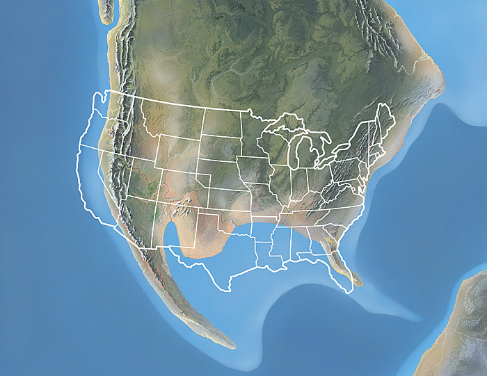
SK9624 - North America, Late Jurassic period. Image 5 of 9. Computer artwork of the Late Jurassic period stage (approximately 161 to 145 million years ago) of a sequence showing the formation of the North American continent. The continents are slowly moved over the surface of the Earth by currents in the fluid mantle below the crust. Over millions of years the continents moved into the positions they are in today. The present day position of the United States of America (USA) is shown outlined in white. For North America at different points throughout prehistory, see images E402/163 to E402/171.
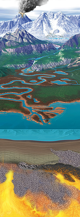
SP7290 - Rock formation and erosion cycle. Cutaway artwork showing the cycle by which rocks are formed and eroded. At top, volcanic activity forms new rock on the Earth's surface as molten rock (lava) rises from the Earth's mantle (bottom). Weathering and erosion processes then slowly over thousands of years wear down the rock. Wind and water transport the eroded rock, and sediment is deposited at the mouths of rivers and on ocean beds. River deltas may form new land, but the layered ocean sediment is returned to the mantle (orange) at subduction zones, or lifted up by tectonic activity to be eroded once more.
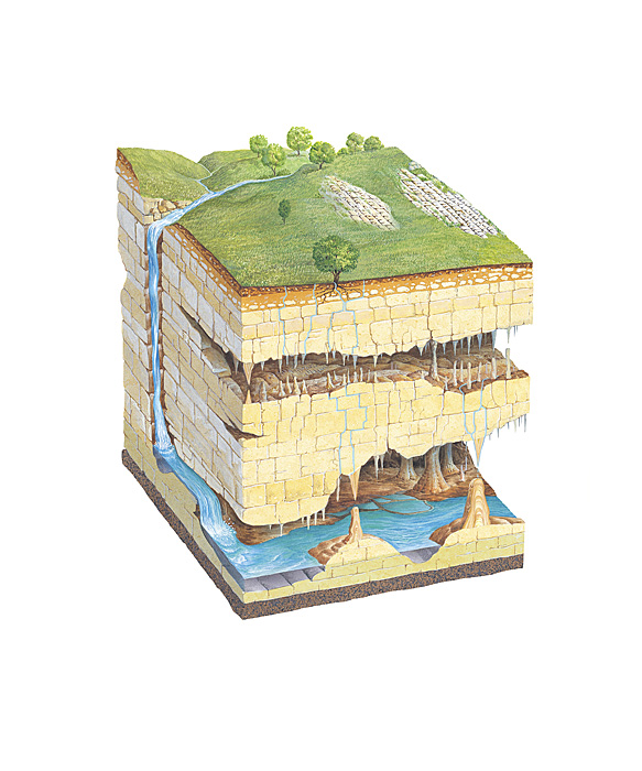
SQ7578 - Karst landscape geology. Cutaway artwork showing the features of a karst limestone landscape formed by erosion. The limestone rock has been shaped by natural chemical erosion. Carbon dioxide in the air dissolves in rainwater to form carbonic acid. This acid erodes the limestone rock as the water flows over it. At left, a river flows down into the ground to form an underground river (across bottom). Two layers of caves are shown, with water seeping down from above to form stalactites, stalagmites, which can join to form large pillars. At upper right, the rock has been exposed, forming a limestone pavement.


